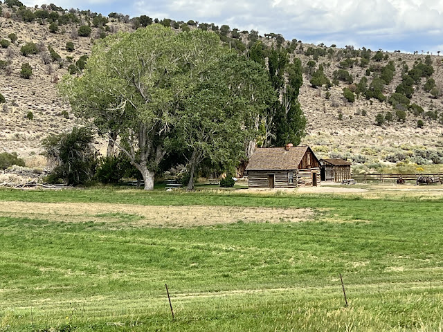
Robert LeRoy Parker grew up near here
Robert LeRoy Parker was born on April 13, 1866, in Beaver, UT. He was the oldest of 13 children born to Mormon parents who immigrated from England in 1856 to assist the church in settling the area. His parents moved the family to a small ranch in Circleville, UT in 1879, where they farmed and raised cattle. At 15, Parker began working on other ranches in the area, where he met Mike Cassidy, a cattle rustler who taught him how to use a gun and how to train horses. In 1889, he pulled off his first bank robbery in Telluride, CO, and shortly thereafter changed his name to Roy Cassidy in honor of his mentor. Later, he took a job as a butcher in Rock Springs, WY, and became known as Butcher Cassidy; shortly thereafter it was shortened to Butch Cassidy. As time progressed, he used areas such as those that are now National Parks to hide out from the law.
If you drive from Bryce Canyon National Park to Capitol Reef National Park on Route 89, you’ll come across his childhood home in Circleville, UT, located right next to the road. It is currently under reconstructive preservation.
Capitol Reef National Park’s distinctive geologic feature, called the Waterpocket Fold, is a wrinkle in the earth’s crust that stretches nearly a hundred miles from Thousand Lake Mountain to Lake Powell. Three gradual, yet powerful geologic forces form it over time, deposition, uplift, and erosion. The result is a monocline, or one-sided fold, in the otherwise horizontal rock layers.
Ancestors of today’s Hopi, Zuni, Paiute, and others made this red-rock oasis their home. Cliffs created natural barriers to wind and storms while rivers created corridors for travel. They left behind petroglyphs, sacred items, and everyday items that tell of a lasting connection to the land.
We visited the Fruita region, which encompasses the Fruita Cliffs (where the petroglyphs are located near the bottom of the cliff face) and the old school building. At one point as many as eight Mormon families occupied this location, and built a school that doubled as a church for worship services. The families concentrated on fruit orchards and vegetables, since the area near the river was perfect for growing them. Fruit was also used as an item for barter.
We went hiking up a trail leading to Hickman Bridge, a huge rock bridge spanning two outcroppings. It’s an uphill and downhill climb that increases in overall elevation around 400 ft over approximately one mile in distance, but the extremely rocky and uneven “trail” is challenging, particularly at our ages. The bridge was impressive, and so was the view from the far side.
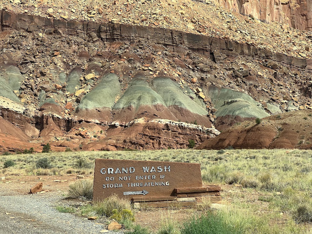
Finally, we drove the scenic trail south from the visitor center. There are a number of engineered road “crossings” that provide a depression for water and mud during flash floods to cross the road without washing it out. After such an event, a front end loader comes in and pushes all the mud and debris off of the road.
Next, the last stop in Utah.


I've been enjoying your travels throughout, even more so this week as Michael and I have both been incarcerated with Covid! Doing well, but it's been lovely to travel vicariously during this little bout. Loved your photos of Bryce...all of your pictures are fabulous. Wondering how the drought feels 'out there?' Keep on....!
ReplyDelete